
Introduction & Objectives
The U.S. Navy’s Marine Species Monitoring Program has sponsored autonomous real-time passive acoustic monitoring for large whales in the mid-Atlantic region since 2019, first utilizing Slocum G3 gliders and later shifting to moored buoys. The primary intent of this work is to contribute to the broader effort to monitoring for the presence of North Atlantic right whales although the system is capable of detecting several species of baleen whales.
Technical Approach
Attempts to capture turtles will occur within the vicinity of military facilities and training areas using a 300‐600 ft tangle net and dip nets (in ocean waters in spring). Example locations include 1) between Little Creek Inlet and Fort Story; 2) between Little Creek Inlet and the Back River in Hampton; and 3) between the southern side of the mouth of the York River and the eastern side of Mobjack Bay, and in the MINEX training area.
Tangle nets can be deployed in 6‐10 feet of water for 3‐6 hours, depending on weather, tidal current and presence of non‐target species (especially bottlenose dolphins) in the area. Tangle net deployment requires two-three vessels. A larger processing vessel with shade, a vessel to approach, harass and turn groups of bottlenose dolphins away from the net (sea turtle capture is allowed as part of National Marine Fisheries Service Endangered Species Research Permit 16134 to deploy the tangle net, and VAQ’s Marine Mammal Protection Act General Authorization 17235 to harass bottlenose dolphins for research purposes), and a small inflatable to check the net and boat captured turtles.
If too few wild turtles are caught, two other options exist to deploy tags. Pound net fishers in lower Chesapeake Bay report turtles to VAQ that are incidentally caught in the nets’ open fish traps, and they can be tagged after retrieval and appropriate health assessments occur. Additionally, stranded turtles that have been rehabilitated and slated for release can be tagged.
Data will be analyzed jointly by the Navy and Virginia Aquarium scientists. Analyses include home range estimates for individuals as well as all tagged turtles combined, residency time, a ‘ground truthing’ of the receiver array using animals tagged with both types of tags, and a habitat model, time and resources permitting. All analyses performed will utilize current GIS techniques supported by scientific literature.
Progress & Results
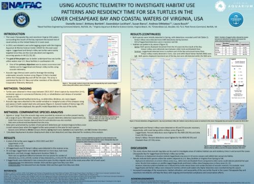
Field work was conducted during the summers of 2013-2018. During that time 90 VEMCO sonic tags and 61 satellite telemetry tags were deployed on a combination of loggerhead, green, and Kemp's ridley turtles (See Barco et al. 2017 and Barco et al. 2018 for details of how turtles were acquired as well as tagging procedures). A switching state space model was also developed for loggerheads using tag data that had previously been collected from 2007 to 2015 (pooled from previous projects in addition to the current tagging efforts) to provide a behavioral context to the detection data acquired by the acoustic tags. Identifying foraging versus migratory behavior allows us to better understand the presence of turtles in military zones and how they might use the habitat.
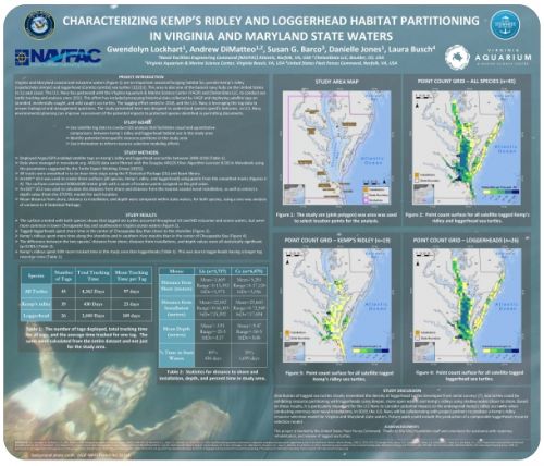
The satellite telemetry data have been analyzed to estimate local home range and assess foraging behavior of loggerheads (see Barco et al. 2017), as well as a home range and foraging analysis for Kemp’s ridley turtles (DiMatteo et al. 2021). Additional analyses to develop state-space switching and habitat models for both loggerhead and Kemp’s ridley turtles in the Chesapeake Bay have also been finalized and the manuscript published in early 2022 (DiMatteo et al. 2022). For more details on the final results of this project, please see the cumulative technical report that was completed in August 2020 (DiMatteo et al. 2020).
Habitat models and assessment of habitat partitioning for Kemp’s ridley and loggerhead marine turtles foraging in Chesapeake Bay (in press).
Project Information
Timeline
2013 through 2018
Location
Lower Chesapeake Bay (Hampton Roads)
Satellite, GPS, and acoustic telemetry tags
Principal Investigators
Susan Barco, Senior Scientist
Virginia Aquarium & Marine Science Center
Sponsor(s) & Funding
FY13 - $180K, FY14 - $195K, FY15 - $70k, FY16 - $183k, FY17 - $104K, FY18 - $0, FY19 - $21k, FY20 - $20K
Point of Contacts
Project Manager
Danielle Jones, NAVFAC Atlantic
Environmental Conservation, Marine Resources Section
Program Manager
Joel T. Bell, NAVFAC Atlantic
Environmental Conservation, Marine Resources Section
Data, Reports, & Publications
Data
Satellite telemetry data:
